



Collector Resumes Statutory Inquiry into Rights within Changthang High Altitude Cold Desert Wildlife Sanctuary.
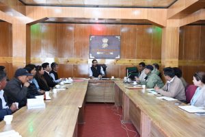
Collector Resumes Statutory Inquiry into Rights within Changthang High Altitude Cold Desert Wildlife Sanctuary.
Nyoma,September 16,2026:-Following directions issued by the Commissioner/Secretary, Forest, Ecology & Environment Department, UT Ladakh (Order No. 48 dated 21.08.2026), the Sub-Divisional Magistrate, Nyoma, in his capacity as the designated Collector under SRO-302 dated 21.08.2007, convened an inter-departmental stakeholder meeting to formally order the immediate resumption and time-bound completion of proceedings for determining rights within the High Altitude Cold Desert Wildlife Sanctuary, Changthang.
Originally notified under Section 17 of the J&K Wildlife (Protection) Act, 1978, the Sanctuary encompasses ecologically sensitive landscapes alongside traditional grazing areas, local habitations, and critical government and defense installations. The Collector issued comprehensive directions to ensure a transparent, evidence-based, and participatory process that balances local community rights with wildlife conservation and national security needs.
Key Directions Issued by the Collector:
Public Proclamation & Claims: A formal public notice will be issued across Gram Panchayats and remote habitations, inviting individuals and local communities to submit claims regarding land ownership, customary usage, and traditional grazing rights within the prescribed statutory period.
Inter-Departmental Land Inventory: The Tehsildars of Nyoma, Durbuk, Chumathang, and Anlay, in coordination with the Wildlife, Forest, Animal Husbandry, and Sheep Husbandry Departments, have been directed to prepare a consolidated village-wise land inventory mapping private, community, government, and pastoral areas.
Defense & Strategic Sensitivity: Recognizing the border location of the Sanctuary, spatial mapping and field surveys of military installations will be conducted in close coordination with Police and Defense authorities, subject to strict national security protocols.
Modern Surveying & Scientific Assessment: Joint ground verification will utilize GPS/GIS mapping, geo-referencing, and satellite imagery. Parallelly, Wildlife authorities will complete scientific mapping of critical habitats and movement corridors.
Zero Tolerance for Fresh Encroachments: The Collector clarified that the resumption of proceedings will not validate any fresh encroachment or unauthorized construction post statutory cut-off dates.
Fair Hearing & Progress Tracking: All claimants will be afforded due opportunity of hearing before issuing final speaking orders. Field officers have been instructed to submit fortnightly progress reports to ensure time-bound completion.